Name
Petra-TsikhisdziriCurrent Name
TsikhisdziriAncient Name
PetraMedieval Name
Petra (early Middle Ages), Tsikhisdziri (late Middle Ages)History of the name
“Petra” derives from Greek Πέτρα meaning rock. According to Procopius of Caesarea, the name was given to the fortified town because of its rocky relief.
Place :
Country
GeorgiaGeopolitical Unit
Administrative subdivision
Tsikhisdziri village, Kobuleti Municipality, Autonomous Republic of AdjaraLocation
Historic fortified town of Petra is located on the southeastern shore of the Black Sea, near the village of Tsikhisdziri, 7 km south of Kobuleti and 17 km north of Batumi. The remains of the fortress stand on the hill by the seaside.Foudation Date
Sixth centuryCurrent condition
The area in the immediate vicinity of the fortress is uninhabited. Nearby is the village of Tsikhisdziri, which has about 2250 residents. It is a seaside resort with a small beach, a railway platform (whistle station), hotels, guesthouses, restaurants, etc. The village lies on the European route E70.History
Based on the sixth-century Byzantine sources (Procopius of Caesarea, Justinian's Novels) and archeological evidence, the majority of scholars identify the fortified complex preserved in the modern village of Tsikhisdziri as the historical fortified city of Petra (though there are other opinions about the location of Petra). The geographic location, topography and relief of Petra as they are described in the Byzantine sources coincide with those of the ruins preserved in Tsikhisdziri.
Archaeological excavations in and around the Tsikhisdziri fortress revealed cultural layers that date back to the first millennium BC. However, the settlement acquired particular importance from 530s. According to the Justinian's Novels, the Emperor Justinian made Petra a city, which was named after him. Procopius of Caesarea calls this place Petra and notes that it had been less important before Justinian who built there the city of Petra on coastal hills.
Petra was situated on a very important military and trade route, which connected the Byzantine Empire with Western Georgia (Lazica), Armenia, and Iran. It had an essential role in controlling sea and coastal navigation from Byzantium to the eastern shore of the Black sea. It was its location and fortification that made Petra one of the most significant strategic points for the Byzantine political and military domination in Lazica. The city became one of the main battlefields during the Lazic War between the Byzantine Empire and Sassanid Persia that lasted for twenty years, from 541 to 562, with varying success. The story of sieges of Petra first by Persians and then by Byzantines is told by Procopius of Caesarea. He describes Petra as hard-to-reach stronghold, protected by sea, rocky hills and fortification.
Nowadays, Tsikhisdziri preserves the remains of the city acropolis. However, archeological excavations testify that territory of Petra was even larger and was extended to the lowland, to the north of the acropolis. Presumably, the significant part of the city is covered by the sea.
As witnessed by Byzantine chronicles, architectural monuments, and archeological materials, the sixth century was the prosperity time of the city. It retained its defensive importance in the Middle Ages. In fifteenth and sixteenth centuries, the fortress belonged to the semi-independent Guria Principality. In 1570s, it was captured by Ottomans and remained under their rule until 1878. Ottomans repaired the fortress and kept a small garrison there. Activity of Ottomans in the fortress is confirmed by archeological materials found during excavations. In 1878, together with other parts of Adjara, Tsikhisdziri was annexed by the Russian Empire in accordance with the Treaty of San Stefano between Russia and the Ottoman Empire.
The archeological investigations of the territory of Petra started in the 1930s and continue until now. Discoveries on acropolis and adjacent areas cover discoveries cover a broad range of time from pre-antiquity up to late medieval and early modern periods.
At present, the site functions as a museum-reserve.
Description
Erected on two coastal hills, the acropolis of Petra was well protected by sea and rocky terrain. In addition, it was enclosed by double massive stone walls. Inner fortress is situated on a northern hill. Remnants of the fortress are preserved at the southern hill as well. These two parts of fortress standing on two hills are connected by parallel walls.
The inner fortress is preserved in better condition. Its length is approximately 200m and the width is 100m.
At present, the fortress is much damaged; some parts of walls are almost collapsed. Apart from the fortification, a basilica, a single-nave church, a bath house and other buildings are preserved inside the inner fortress.
Main building periods of the fortress:
Sixth century - the original date of the fortress.
• Three nave basilica is located in the centre of the inner fortress. It is a sizeable building elongated in plan, with pentagonal projecting sanctuary on the east and the narthex on the west. Five pairs of piers stood in the interior separating the nave from the aisles. Walls were faced with finished stone blocks. The floor was covered with mosaics. Church is preserved on its ground plan level. Presumably, the basilica served as a See of the Bishop of Petra. The wall fragments of earlier building are visible under the church. When basilica collapsed another church was built over the old one.
• Bath-house (9.2×6.5m) preserved in ruins. The building composed of five different functional sections arranged in enfilade. The bath-house of Petra belongs to the Roman thermal type of baths.
• Apparently utility building (25×5m) at the southwest part of the inner fortress.
• Fortification walls are reinforced with four towers and have two entrance gates. They have been restored several times but certain parts of them as well as the entrance gate of the inner fortress at the north hill and some fragments of the entrance gate at the south hill (including its towers) can be dated back to sixth century. The walls are built of roughly cut stone and cobblestone, with brick insertions. The height of the walls in some parts reaches up to 7-8 m.
• Archeological objects: ceramics and glass items, building ceramics (bricks, tiles) etc.
10th-14th Centuries
• A small (9.75×9.0m) single nave church with projecting apse on the east was constructed over the sixth century basilica after its destruction. The church is built of stone with brick insertions. Nowadays the church is severely damaged - only the north wall and the part of the apse are preserved. Later alterations are evident as well. Small fragments of wall painting were discovered during archeological works.
• Archeological objects: Byzantine lead seal with the image of St. George and Greek inscriptions (10th and 11th centuries); fragments of ceramics, jewelry, etc.
18th-19th Centuries
• Reconstruction of the significant parts of the fortification walls; archeological objects (glazed ceramics and etc.)
Archeological excavations carried out on the acropolis and on its nearby areas have revealed pre-antique, classical, Hellenistic, late antique and early Christian cultural layers.
In lowland area, north from the acropolis archeological works exposed ruins of several structures, among them a group of early Christian (fourth to sixth centuries) buildings including a basilica, a palace, bath-houses, a single nave church, etc. Ceramics, glass items, and coins are found out as well. Also, several burials with accompanying artefacts from late antique and early Christian periods were discovered in Tsikhisdziri.
Archeological excavations as well as chance findings created a rich numismatic collection that covers a broad range of time and includes Roman, Byzantine, Parthian, Sasanian, Arabic, and Ottoman coins. The majority of Byzantine coins come from the mint of Constantinople. Among them are golden coin of Justinian I and Justinian II.
The most significant chance finding was so called "Tsikhisdziri treasure", which is kept at St. Petersburg State Hermitage Museum. It presents the burial artefacts of late Roman period (2th-3th cc.) and consist of golden jewelry, gemmas, silver and bronze objects.
Harbor
Today, there is no contemporary port near the Petra fortress. No traces of historical harbor have been discovered until now. However, the archeological investigations of the Tsikhisdziri site are not completed yet. It should be taken into consideration that the part of the site is underneath the sea today. Numismatic samples testify an active trade and economic relations between Petra and other countries and with Byzantium in particular, as majority of coins found on the site are Byzantine (coins of Justinian I, Justinian II, Leon VI, Romanos I, Constantine VIII, etc.)
Fortification
At present, south, north and east walls of fortification and four towers are more or less preserved; while south-west and north-west wall of fortification are almost ruined and only small fragments are preserved.
The original date of fortification is sixth century. Lower portions of its walls, towers, and entrance gates date back to that period. In some parts, a typical Byzantine building technique opus mixtum can be observed.
During the centuries the fortification was damaged several times and underwent many reconstructions and restorations. It resulted in various building layers that demonstrate different building techniques and materials. The most significant restorations of the fortress were carried out by Ottomans in eighteenth and nineteenth centuries.
Medieval Sites
Tsikhisdziri-Petra Fortress; Petra-Tsikhisdziri Museum-Reserve; Batumi Archaeological Museum; Batumi Chariton Akhvlediani State Museum
Textual Sources
Procopius of Caesarea, B.P. II, 15, 17, 29; B. G. VIII, 11. Justinian Novelai, 31
Bibliography
S. Janashia, Studies, I (Tbilisi 1949, in Georgian); S. Kaukhchishvili, Georgica, II, (Tbilisi, 1965, in Georgian); A. Inaishvili, Results of Petra-Tsikhisdziri Excavations of 1962-1965, Monuments of South-West Georgia, 4 (Tbilisi, 1974, in Georgian); N. Inaishvili, Archeological Monuments of Tsikhisdziri of the First to the Sixth Centuries, (Tbilisi, 1993, in Georgian, with Russian summary); D. Braund, Georgia in Antiquity (Oxford - New York, 1994); G. Tsetskhladze, Pichvnari and its Environs (Besançon, 1999); P. Zakaraia, The History of Georgian Fortifications from Ancient Times to the End of the Eighteenth Century, (Tbilisi, 2002, in Georgian).
Links
http://www.tourismadjara.ge/new/index.php?a=main&pid=43&lang=eng
Visual Material
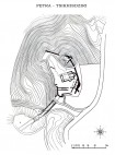
01. Petra-Tsikhisdziri. General Plan of the Fortress.
02. Petra-Tsikhisdziri. Plans of the Church and the Bath House in the Fortress.
03. Petra-Tsikhisdziri. View of the Black Sea from the Fortress.
04. Petra-Tsikhisdziri. Vaulted Tomb in the Fortress.
05. Petra-Tsikhisdziri. The Church in the Fortress, Looking North
06. Petra-Tsikhisdziri. The Church in the Fortress, looking North-West.
07. Petra-Tsikhisdziri. The Church in the Fortress, looking West.
08. Petra-Tsikhisdziri. The Church and the Citadel of the Fortress.
09. Petra-Tsikhisdziri. General View of the Fortress, Looking South


