Name
MaroniaCurrent Name
MaroniaAncient Name
MaroniaMedieval Name
MaroniaHistory of the name
According to tradition, Maronia got its name from its founder Maronas, son of Evanthi from Chios.
Place :
Country
GreeceGeopolitical Unit
ThraceAdministrative subdivision
Prefecture of Rodopi, Municipality of MaroniaLocation
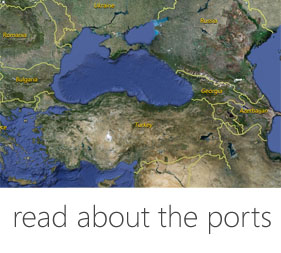
The archaeological site is located on the seafront of Hagios Charalampos, about 4 klm. southern of the current village of Maronia.Foudation Date
First half of 7th century BC.Current condition
Today, a few kilometres to the North of the ancient location, there is located a small modern settlement.History
Human traces all the way back from the New Stone Ages are found in the area. We find written references to Maronia in Homer, Herodotus and Stravo.
In the 7th century it was inhabited by colonists from Chios. It’s founder was Maronas. The city flourished during antiquity as well as during the early Christian times. Its residents started dealing with trade and the sea from a very early time in history.
During the Persian Wars, Maronia was subdued to the Persians. Later on took part in the 1st Athenian Allegiance, while the 4th century BC is the time of its great prime.
In 350 BC, after a failed attempt to take over the city, (353 BC), Filippos II subdues Maronia and adds it to his kingdom. In the Hellenistic times the city constantly changes dominators.
In the roman era, Maronia which was favored by the Romans for a long time meets great commercial and financial rise. It is also mentioned as one of the cities which the emperor Adrian visited.
The city continued its life as an Episcopal center during the byzantine times as well. However, it shrunk and limited to the area near the sea and developed characteristics of a fortified city-castle.
In the 9th-10th century, Maronia followed the general trend of reorganization and rearrangement in the urban centers, while in the 11th century it became an Archdiocese.
From the archaeological findings comes up the fact that Maronia used to be an important agricultural, commercial and industrial center, up until the first half of the 13th century.
During the 17th-18th century, the pirate invasions forced the residents to retract from the seafront and to build their settlement 14 klm towards the inland, where the modern village of Maronia is located. This settlement is the only one characterized as “Traditional settlement” in Thrace.
Description
The archaeological remnants reassure that Maronia used to be a city – port of the Northern Aegean which had continuous life from Antiquity to the Middle Ages.
Many funerary inscriptions are preserved from the early Christian era, as well as vaulted tombs, 6th and 7th century sculptures, parts of a bath complex, an atrium of a large basilica covered by mosaic floors, as well as traces of two other basilicas under more recent churches.
Form the byzantine era, there is preserved a church from the 11th c., dwellings and part of a road. Furthermore, many portable findings have come to light, amongst them pottery which dates back to the 9th c. up until the time of the Palaiologoi. On the outer corners of the towers of the byzantine forting enclosure, wine-making tanks made of stone which were for public use, are being preserved.
Harbor
The port of Maronia favoured trading, exports and communication with other commercial centers. The tanks found near the towers show that there were large fields of grapevines in the area. The wine of Maronia is well-known since the time Homer.
Traces of the classical coastal fortification were found under the byzantine walls, near the port.
The natural cove secured it from the winds, while probably in the 4th c. BC, the time of the city’s great prime; an artificial harbor was constructed to better protect the commercial and military fleet. A breakwater started from the eastern end of the cove. This breakwater extended into the sea about 170m. It then made a turn with a North-West direction and it extended for another 130m. The existence of a second breakwater from the West is unknown.
After the population moved towards the inland in the 17th-18thc., the residents destroyed and buried the old port so that pirates would not find shelter there.
Today’s seaport of Maronia is Hagios Charalampos which is located where the byzantine Maronia used to be. The new breakwater stands on part of the ancient one.
Fortification
The position of the first settlement of Chios residents is not completely verified. It probably developed where the later acropolis stand, on a steep area of 461m. height in the position of Hagios Georgios, South-East of classical Maronia. This acropolis continues to be used after the construction of the strong classical enclosure of Maronia.
The perimeter of the enclosure of the classical city was 10.400m and local stone was used for its construction. Several parts are being preserved nowadays (maximum height 2 m – thickness 2,30 – 3m.) with rectangular and semi-circular towers. It starts from the settlement’s acropolis which is located on the highest point of mount Ismaros and has two parts which cover a great area but only at the lower lowlands near the sea. The rest of the area was used for the safety of its rural population during times of invasions.
Two smaller walls which reach the sea stand lower on the southern – older acropolis. In the eastern tower, at its middle, a second smaller enclosure is preserved, in order to reinforce this lowland part.
The byzantine fortification of Maronia, which noticeably restricted the surface of the ancient city, with its wall, pre-walling and towers, has not been exactly dated yet.
Medieval Sites
Archaeological Sites:
Cyclops Polyfemos cave
Monuments:
Ancient Theater
Parts of the fortification of the ancient city
Monumental Propylon of the Roman times
Dionysos Sanctuary
Mosaic floor from 3rd c. BC house
Museums:
Archaeological Collection of Maronia (Archontiko Tavanioti)
Folklore Museum Xylaganis
http://www.xylagani-mouseio.gr/
Textual Sources
Hρόδοτος. 7.185
Στράβων,7.44.25, 7.47, 7.48.10
Livy XXXVIII, 41. 8
Mela 2. 28
Bibliography
• Αλιμπράντης Θ., Βυζαντινή Μαρώνεια. Ανασκαφή στον Άγιο Χαράλαμπο, Θεσσαλονίκη 1994.
• Αναγνωστοπούλου – Χατζηπολυχρόνη Η., Ανασκαφικές έρευνες στη Μαρώνεια και στα Σύμβολα, ΑΕΜΘ 1 (1987), σ. 439 – 443.
• Asdracha C., La region des Rhodopes aux XIIIe et XIVe siecles. Etude de geographie historique, Αθήνα 1976, σ. 98-104
• Δουκατά Σ., Ευρήματα παλαιοχριστιανικής και βυζαντινής περιόδου στην Παληόχωρα Μαρωνείας, ΑΕΜΘ 5 (1991), σ. 497-513
• Δουκατά-Δεμερτζή Σ., Η βυζαντινή Μαρώνεια από τα κινητά ευρήματα της ανασκαφής στην Παληόχωρα Μαρωνείας, ΑΕΜΘ 8 (1994), σ. 359-370
• Δουκατά-Δεμερτζή Σ., Μεσοβυζαντινό ναύδριο στη βασιλική της Παληόχωρας Μαρωνείας, ΑΕΜΘ 11 (1997), σ. 645-661.
• Ζήκος Ν., Βυζαντινό οδοιπορικό στη Θράκη, Αρχαιολογία 13 (1984), σ. 75.
• Μπακιρτζης Χ., Βυζαντινή Θράκη, Θράκη, Γενική Γραμματεία Περιφέρειας Ανατ. Μακεδονίας – Θράκης, 1994, σ. 165 – 171.
• Σαρλά – Πεντάζου Μ., Πεντάζος Β, Μαρώνεια, Αρχαιολογία 13 (1984), σ. 44 – 49.
Links
http://maroneia-sapes.gr/ms/arxeio/13
http://odysseus.culture.gr/h/3/gh351.jsp?obj_id=2512
http://www.xanthi.ilsp.gr/cultureportalweb/article.php?article_id=845&topic_id=43&level=4&belongs=38&area_id=59&lang=gr
http://www.xanthi.ilsp.gr/cultureportalweb/article.php?article_id=829&topic_id=43&level=4&belongs=38&area_id=59&lang=gr


 DIGITAL MEDIA STUDIO