Name
ByalaCurrent Name
ByalaAncient Name
Unknown (Larisa?)Medieval Name
Viza (?); also mentioned as Viccia, Lauiza, LauitzaHistory of the name
Larisa is a name mentioned only by Strabo as a village located on the Western Black Sea coast between Messambria and Odessos.
Visa – probably of pre-Greek: Thracian or Carian origin but as a later survival is known from the Byzantine poem of Manuel Philes dated 14th c. and sea maps and portolani of the same period.
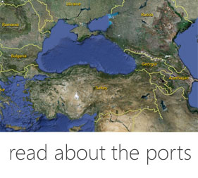
Place :
Country
BulgariaGeopolitical Unit
Balkan peninsula, Western Black Sea coastAdministrative subdivision
Varna Region, North-Eastern regionLocation
About 50 km. south of Varna, north of cape St. Athanasius, but the Late Antique port is situated south of the cape.Foudation Date
The Late Antique fortress on cape Sv. Atanas was erected in very late 4th- early 5th c. AD. It was destroyed and abandoned by the end of 6th – beginning of 7th c. during the incursions of Avars and Slavs. It has not been reconstructed in later times.Current condition
Byala is a town in Varna Region located at 50 km South of Varna on the border with Burgas Region. Population of c. 3000, an active resort centre. Main activities are tourism and agriculture. There are numerous newly built small and large hotels, residential complexes, a city information centre, a museum and library. Summertime tourism attracts many people between May and August. There are several beaches within the city environs. The town provides large opportunities for cultural and rural tourism. In- and around Byala there are many vineyards and fruit gardens and grow various crops. There is a well known winery with an wine cellar and some small private enterprises: for producing furniture, construction materials and many more. Retail is well organised. During summer time, the town hosts several annual cultural activities: folk art festivals – for singing and dancing with international participants, workshops for painting, wood sculptures and crafts where renowned Bulgarian and international artists take part. In August takes place a week of the sea with series of concerts and other performances – classical, rock, pop and folk music. Many foreigners own apartments in the town and summertime the local population more than triples.History
In the area of cape St. Atanas there have been discovered artefacts of Late Eneolithic and Early Bronze Age (5th – 4th millennium BC). Between 6th and 1st c. BC the cape was an important Thracian cult centre. More than 120 pits connected to cult ceremonies and rituals of local people of the region have been discovered during excavation during the past five years. They contained a large variety of artefacts – locally made and imported ceramics, coins and metal objects, animal bones, etc. There was discovered also the remains of a temple of ca 4th-1st c. BC. The Thracian settlement in this period which the sacred area belonged to was located probably not much far away, underneath the modern town of Byala and near the main town beach. For unknown reasons in very Late Hellenistic period (late 1st c. BC) this religious centre declined and was not in use any more. In the Roman period (3rd c. AD) on the cape there existed a sanctuary dedicated to Heracles. By the end of 4th – beginning of 5th c. AD, a large fortified with strong walls town covering an area of about 35 ha emerged. It was well planned with streets and residential areas, and early Christian basilica, baptistery and a sacred well) near it. Excavations have discovered remnants of three wineries, several ceramic kilns, two Late Antique baths and many houses and workshops. The port is located south of the cape, where during underwater investigations stone and lead anchor stocks, ceramics dated to the 4th – 6th c. AD and 15th-18th c. has been found. In the middle of 5th c. the town was captured, burned. In the following decades it established itself as an industrial, trade and religious centre. Possibly since the middle of 6th c. it became a Christian Episcopal see. It perished under the blows of Avar and Slavs invasion of AD 614-616, when the last coins found at the site are dated. No settlement arose over the site later. Traces of medieval settlement were found North of the Late Antique town, but at some distance. No excavations have been undertaken in this area.
In 1305 the Byzantine poet Manuel Philes wrote a panagyric poem for the exploits of the Byzantine military commander protostrator Michael Doukas Glabas Tarchaneiotes. In the part dealing with the military campaign against the Bulgarian King Ivaylo in 1278 he mentioned a fortress named Viccia near Kozyak (modern Obzor): He took Viccia, which had no connection... He took the entire lands of Emona. He was master of the fortress and town of Kozyak, and…he took afterward the valley of Kariya...
The name of the Medieval town under spelling Lauitza is mentioned also in the Genoese description of Western Black Sea coast among those within Bulgaria or Dobrudja: To Bulgaria or Dobrudja:[belong] Lauitza, Galata, Varna, Ketritzi, Gavarna, Caliacra... The same name of a port is marked on the contemporary in time sea-fare maps. The Medieval fortified town Kozyak (modern Obzor), located on the Southern end of a large open to the winds following bay used the port of Viza for its own needs too The port was active in Medieval age at least since 11th probably up to 15th-16th centuries.
Description
The fortress walls closed Cape St. Atanas from the North-Eastern to Southern slope and protected an area of about 35 ha. The wall was built by hewn stones and filling of mortar and chopped stones. In front- and in parallel of it at 10 m distance there was also a deep ditch used for additional protection. The fortification wall was excavated in four sectors but it is poorly preserved: only in foundations or tracked as negative of extracted a long time age stones. The available data shows that it was erected as a two-sided wall 1.80 m wide carefully levelled and fixed by with mortar. The wall foundations were dug up to 1.20 m from the level of the ancient terrain. The main gate of the fortress was located probably almost in the middle of the Western wall. Evidence for such conclusions provided the discovered wide street paved by large limestone slabs, which starts from this point. Partial excavation farther North revealed a still visible bend of the discovered part of the wall, which provides evidence to conclude that a circular tower was located there.
Harbor
Today: There is a pier for small boats and yachts constructed in the bay South of Cape Sv. Atanas close to one of the town beaches. The cape itself is well protecting the bay from North-Eastern winds. There is an idea of building there a new yacht-harbour suitable for larger boats.
Past:
The port is located in the bay South of Cape Sv. Atanas. The cape has significantly decreased its size in time from the East and partially from South due to long time running erosion processes of the sea, but still gives a good protection. According to Shkorpil brothers, founders of Bulgarian archaeology, in the beginning of 20th century there were still visible underwater stone enclosures of port’s facilities. However, during underwater archaeological researches conducted in 1970-1980ies of 20th c., this has not been proved. Maybe the reason is that in the passed time of about one cent, the remains were demolished by the sea and construction works of the modern port. Archaeological artefacts of various periods have been found in the Visa harbour area during the archaeological research at a depth of 8 m, along the underwater reef, which is located in North-West – South-East direction. They consist of Ancient anchor stocks: one made of stone, two lead ones with bolt hole and without limiting fret | all usually dated to the late 1stmillennium BC –early first millennium AD , late Medieval (16th-18th c.) iron anchors of so-called “Admiralty type” and included also a variety of ceramics fragments of Late Amtiquity and Late Medieval period.. Judging by the artefacts found one may conclude that the bay South of cape St. Atanas was used extensively during two periods: 6th c. BC – 6th c. AD and later - since 13th – 14th centuries until 19th century.
The name of the port does not appear in the first Black Sea loci from 1296 - Compass in sailing. It appeared though in portolani and maps dated after the first decades of 14th c. and onwards. It was mentioned in a few 14th c. Italian portolani: From Miscuria to the bay Limano (Emona, Emine) of 4 degrees east-north-east there are 30 miles. From the Limano bay to the south Visa northward there are 15 miles. From Negro molo (Black cape) to Galata there are 10 miles.
A 14th century Venetian portolan provides information about a port named Vize located north of Emona and before Black cape: From Misivri to Lemano cape (Emine) on the map from northeast to east there are 30 miles. From Lemano cape to Vize there are 15 miles. From Vize to Mauro molo (Black cape) there are 15 miles. From Mauro molo to Galata there are 15 miles.
A port named Visa is included in other Italian portolani dated beginning of 15th century. It is located again in equal distance between Emona and Cherny nos (Black cape): From Miscuria (Messembria) to Cavo di Lemano (Emine) on quarter north-east – east there are 30 miles. From Cavo di Lemano to Viza in direction from south-east to north-west there are 15 miles. From Black cape to Galata there are 10 miles.
In the 1311 map of Petrus Visconti the port is marked after Emona with the name Craviza. In a 1318 map by the same cartographer it is marked between Cavo di Lemano (Emona) and Mauro (Black cape) with name Lauiza. In the 1385 map of Guillermo Solleri it is named Viza. On the Francesco Benincasa map dated 1403 it is named Lauiza.
The port was present with those names on several maps of 14th – 16th centuries. It is always located between Emona and the Black cape. On two 15th century maps of Nicola Florino and Alvese Cesano, on the place of Vit is written Leni (?), which might well be a mistake.
Fortification
The fortress wall is preserved mostly underground. The few sections excavated recently and now seen over ground revealed only the foundations of the fortification and maybe a small part of a circular tower.
Medieval Sites
On Cape Sv. Atanas have been excavated and now after conservation are exhibited under protection buildings an Early Christian basilica, its baptisteries, an well preserved winery, the Episcopal residential house, a bath, a pottery kiln as well as some residential and trade buildings, all of 5th – 6th c. AD. There are also small remains of a contemporary to them Late Antique fortress. The site is located at the outskirts of the modern town of Byala and can be easily reached through a specially built new road and a pedestrian walkway with information centre at the beginning point. A lot of inscription plates, layouts, photos and reconstruction drawings reveal the life and fate of the Late Antique fortified town at the cape and its port. There is also a small scale but made in exact proportions reconstruction model of the ancient town, which situated at the entrance of the site.
The modern town has a little but well-run museum exhibiting artefacts from the fortress at Cape Sv. Atanas. Among these the visitor will see hand made Thracian pottery and black-glazed and red-figured imported ancient Greek ceramics of 5th-1st c. BC; a stone anchor stock and small finds of everyday life of same period. There are also marble statuettes and relief votives of Heracles from a 3rd c. AD Roman sanctuary of that deity, located at Cape Sv. Atanas. Most of the artefacts are of Late Antique period (5th-6th c. AD), discovered in the fortified town. The visitor will see a lot of metal objects: bronze lamps and a candelabrum, belt buckles and dress ornaments, pottery and ceramic lamps, inscriptions on stone, many coins, etc. Of special interest are the unique fragments of 5th c. AD mural paintings and painted inscriptions, perfectly preserved marble altar table, marble architectural and chancel screen units, which once decorated the Early Christian basilica of 5th- 6th c. AD and its baptisteries, discovered on the cape. There is a project an existing large building in the centre of the modern town Byala to be reconstructed in 2014-2015 as a new museum and for the needs of a cultural centre.
Textual Sources
Strabo IX 5, 19.
Италиански портулан (препис от ХV в. по оригинал от началото на ХІV в.). – П. Коледаров. Мореплавателни карти, наръчници и други свидетелства за международното значение на Втората българска държава. – Сб. България в света от древността до наши дни. София, 1979, 293–294.
Венециански портулан (ХІV в.). – Б. Димитров. Българските пристанища в ХІІІ–ХІV в. според два портулана. – Археология, ХХІ, 1, 1979, с. 23.
Анонимен италиански портулан (съставен вероятно през ХІV в., но известен по препис от ХV в.). – Б. Димитров. България в средновековната морска картография ХVІ–ХVІІ в. София, 1984, 37.
Димитров, Б. България в средновековната морска картография (ХІV–ХVІІ век). София, МCMLXXXIV, 21, № № 3–6, 9–11, 13–21, 25, 26, 28, 30, 34, 35 до 70.
Атлас. Българските земи в европейската картографска традиция (ІІІ–ХІХ век). София, 2008, № ІІ, 2 - 26.
Bibliography
Б. Димитров. Малки пристанища и крепости. – В: Български средновековни градове и крепости. Варна, 1981, 427.
Б. Димитров, А. Орачев. Пристанищната система по Западнопонтийското крайбрежие (средата на ІІ-І хилядолетие пр. н. е. –Археология, ХХІV, 1, 1982
Б. Димитров. България в средновековната морска картография ХІV–ХVІІ век. София, 1984, 20.
В. Йотов, Ал. Минчев. Късноантична крепост на нос Св. Атанас. София, 2013л
Лазаров, М. 1989. Подводни археологически проучвания в залива на нос Св. Атанас край град Бяла. – Археологически откритя и разкопки – 1988. Кърджали, 173–174
Димитров, Б., А. Орачев. 1982. Пристанищната система по Западнопонтийското крайбрежие (средата на II – I хилядолетие пр. н. е.). – Археология. кн. 1, 1–11
М. Лазаров. Древното корабоплаване па Западното Черноморие. Варна, 2009, 110.
Links
Tourist Information : http://archeology.byala.org/
http://poseti.guide-bulgaria.com/NE/Varna/Byala

 DIGITAL MEDIA STUDIO