Name
KaliakraCurrent Name
KaliakraAncient Name
Tirizis, Trisa/Tirirsa, since 5th century – AkraMedieval Name
CaliacraHistory of the name
The earliest fortified town on the cape has been dated back to 4th c. BC, but the area was populated by the Thracian tribe Tirizi since the Early Iron Age onwards and there is evidence about an earlier Thracian settlement there, which bore the first name – Tirizis. When the Early Hellenistic fortress was erected this appeared in ancient written sources and was connected with Lysimachos, the successor of Alexander the Great in Thrace. The Bulgarian linguist V. Beshevliev considers that the name belongs to an even earlier, pre-Thracian period. In the Synekdemos of Hierocles during 5th – 6th c. AD the fortress and the port were called Akra Castellum or Akra, from the Greek word for cape - Akra. In 13th century on the anonymous map from Pisa and the Corignano map it is marked the port Caliacre, Caliacla, again from Greek words „kalos” – beautiful and „akra” – cape. This source suggests that at latest during that century the fortress acquired its new name. In sea-fare maps, portolani and written sources from the 14th century the port is known mostly with the name Kaliakra – Caliacra, which it keeps until present time. The fortress was marked first on the sea-fare maps of Petrus Visconti drawn between 1313 and 1318. In numerous maps from 14th to 17th c. the name of the fortress and the port appears in various forms - Calliacra, Caiacre, Caliatra, Caiacara, Chaiacre, Calisca, Taiacra, Gaiacla and so on, but these are just different spellings and mistaken transcripts of authors who have only heard the name by oral route. In a Russian 14th century source it is foundalso under the name of Akoliakra.
Place :
Country
BulgariaGeopolitical Unit
Balkan peninsula, Western Black Sea coastAdministrative subdivision
Dobrich region, North-East Region of BulgariaLocation
It is located at 12 km South of Kavarna and 60 km North-East of Varna. The site is situated on a long, narrow cape jutting 2 km South in the sea in the far-most South-Eastern point of the Dobroudja plateau. Nearby are located the villages of Balgarevo and Sveti Nicola, Nature and archaeological reserve. The port was located in the West bay of Cape Kaliakra, well protected in the past from the North and Eastern winds.Foudation Date
On Cape Kaliakra there was a small Thracian settlement named Tirizis possibly since the Early Iron Age (ca 6th-5th c. BC). The fortress was built in late 4th c. LC and this time may be accepted as the time of foundation of the ancient fortified town and its port. Then, the West side of the cape has been settled next to the large bay well protected from North and North-East winds thanks to the 70 m high cliffs of the cape.Current condition
There is no modern settlement on the cape. The impressive archaeological remains – several successive fortress walls from different historical periods: from Hellenistic to Late Middle Ages survived in a good condition through the centuries. They have been excavated and conservation has been made to some parts of them. They are well presented to the public and among them there are visible the remains of other ancient and medieval structures: a public bath, residential and storage buildings, tombs, wells and many more. The port is not in use any more, except rarely by tourist or fishing boats, looking for safe place in bad weather for sailing. On Cape Kaliakra are located a lighthouse, a military and a meteorological station. There is a small, but attractive museum in a cave, which was adapted probably as church in the Middle Ages. On the edge of the cape there is a small modern chapel. A restaurant and many souvenir shops operate in summertime. The fortress is a popular tourist attraction visited annually by hundreds of thousands guests of the Bulgarian Black Sea coast. The road to it is well maintained. Since 1941, the cape and the surrounding area are National nature reserve covering a surface of 687 hectares, including the aquatory. The cape is a National archeological reserve too.History
The earliest traces of occupation on Cape Kaliakra dated back to the Early Iron Age, probably from 6th – 5th c. BC, and there is no doubt that the name comes from the Thracian tribe Tirizi. The settlement becomes more significant only in 4th century BC when during the second half of that century a fortress was erected over it after a Hellenistic model. The fortification became one of the important bases of Lysimachus on the Western Black Sea coast and probably there was stationed a permanent Macedonian garrison. The fortress was preserved in operative form until the Roman period. According to Strabo: The Tiziris cape is a fortified place where once Lysimachus kept his treasures.
In the Anonymous Periples of the Black Sea is mentioned the port of Tiziris. During the several underwater surveys in its aquatory, there have been found 39 stone anchors, stone and lead anchor stocks, Ancient, Late Antique and Medieval ceramics (mostly amphorae), which clearly indicated the intensive use during the entire existence period of the settlement and fortress on the cape: since ca mid- 1st millennium BC until 15th – 16th centuries.
Since 15 AD the cape and its fortress was included in the Roman empire as part of the province Moesia ( later Moesia Inferior- Lower Mosesia), but had no significant importance and its population decreased dramatically. In the Tabula Peutingeriana the fortress is indicated between Kalatis (Mangalia) and Bizone (Kavarna) with the name Trisa. The same name is given in the Cosmographia by Ravennatis anonymi (beginning of 8th century). Between 5th and 7th c. it is mentioned in sources mainly as Akra. After Early 4th c. AD its significance for protection of the Black Sea limes (border) of the Roman Empire increased again and a new fortress wall has been erected farther west of the first one. The Late Antique fortification was erected during the reign of Emperor Valens in late 4th century AD and with numerous changes continued to play significant role in the region until the end of 6th –Early 7th c. AD. The cape became part of the newly established Balkan province of Scythia and one of its main strongholds. The fortress is in the focus of Byzantine chronicles in connection with the rebellion of the Early Byzantine military commander Vitalian in AD 513 against AnastasiusI.. In front of the city walls the army of Vitalian, supported by Huns led by Ernach and Bulgarian troops defeated some 60 000 men strong Byzantine army of the emperor. The Late antique historian Ammianus Marcelinus described Akra as one of the 15 cities of province Scythia. It is mentioned also in the Synekdemos of Hierocles as one of the cities with ports on the Black sea. Most probably Akra was victim of the Koutrigour invasion in AD 559. The fortified town was besieged and destroyed during the Avars and Slavs incursions in the end of 6th or very beginning of 7th c. AD. It was left abandoned and unpopulated for several centuries.
Sometime by the end of 8th century on the territory of the outer town an Early Bulgarian settlement emerged, which existed until the end of 10th century. It had no strategic or other significance for the Bulgarian state and consisted mainly of dugouts or semi-dugouts with stone lined walls. Some of these structures were dug within the ruins of the abandoned ancient city. Therefore we witness only topographical, but not cultural and urban continuity on the site. Following the restoration of the Byzantine authority in the region in 971, or in the beginning of 10th century this settlement was destroyed and abandoned again and life in Kaliakra area was suspended for almost two centuries. There are no discovered artifacts dated within the period of 11th and early 12th century. Life on the cape revived only in the first decades of 12th century when the political situation in the Byzantine empire stabilized after the numerous invasions of Pechenegs and Cumans in 11th-12th centuries. By that time, in the Black Sea trade activities gradually penetrated Venice and Genoa. Whe in the beginning of 13th century Kaliakra was included again in the territory of the Bulgarian Kingdom the importance of the fortress grew significantly. The castle became especially important when it was included within the boundaries of the Dobrudja despotate, which emerged in that part of Bulgaria by the end of 30s of 14th century, established by local Bulgarian nobles. The first references about the Despotate date from 1346, when its Despot Balik sent in support of the Byzantine Empress-mother Anne of Savoy a unit of 1000 heavily armed horsemen headed by his brothers Theodore and Dobrotitsa. This unit assisted in her war against the usurper of the throne John Kantakuzenos. Initially the town of Karvuna, also on the Black Sea Coast and located not far from Kaliakra was the principality center of the Despotate. However after the next despot – Dobrotitsa, returned from Constantinople in 1360 he moved the capital to the better fortified town on Cape Kaliakra. This was the beginning of city heyday.
For the political history of Kaliakra important data are found in the accounting book of Antonius Berberis, cashier of Count Amadeus VI of Savoy during the latter campaign against Bulgarian Black Sea ports in 1366. In November 1366 the Count sent several embassies to despot Dobrotitsa in order to settle peace with the Bulgarian Tsar Ivan Alexander and the return of Emperor John V Palaeologus in Constantinople. Peace was settled with the mediation of Despot Dobrotitsa, the emperor stayed for a short period in Kaliakra and returned to Messembria (Nesebar) by the end of December. Probably after the death of Despot Dobrotitsa in 1385 his son Ivanko moved the capital for a short time in Varna. Reference for such a decision provides the Ottoman chronicles of Mehmet Neshri in his account of the Ali pasha campaign in North-East Bulgaria in 1388. The German knight Hans Shiltberger, who was captured in the battle of the Bulgarian fortress Nicopolis on the Danube in 1396 mentioned that Kaliakra is still center of one of the Bulgarias (because then Bulgarian lands were divided in two Kingdoms and one Despotate) He noted that this is the one, where the Danube flows into the sea: i. e. North-Eastern Bulgaria. Kaliakra was mentioned once again in 1397 when through the port passed the then Hungarian King and later German emperor Sigismund, who was defeated in the same battle of Nicopolis. In a Russian travel guide from the end of 14th c. Kaliakra has been mentioned among the famous Bulgarian cities. Kaliakra was probably conquered by the Ottoman Turks for a short period in 1399 but in 1402 taking advantage of the civil war in the Ottoman Sultanate, the Genovese conquered the important Black Sea fortress. A garrison was deployed in the fortress with the military commander Bartlomeo di Gramaldi in head. However, in 1404 the Walachian voivode Mircea the Elder conquered the Bulgarian North-Eastern part, including Kaliakra. A treaty of 1412 testifies that in the fortress there was still a Walachian voivode – a logothete named Baldwin. The Ottoman Turks conquered the fortress finally around 1417 during the campaigns of Sultan Mehmet I. Kaliakra emergeed again in contemporary sources in connection with the campaign of the Polish-Hungarian King Vladislav III Jagielo in the Blakans.In 1444 he led the last crusaders army of various western and local troops against the Ottomans. According to the Byzantine historian Laonikos in the beginning of November 1444 Chalkokondyles the Kaliakra fortress was “storme” by a squad of knights. The campaign historian Philip Kalimachos wrote that the Turkish garrison has left the fortress without fight after receiving the warning letter from the king. With the stabilization of the Ottoman Empire rule on the Balkan Peninsula in mid-late 15rh century, the fortress gradually lost its strategic significance. Since then the fortress was abandoned by its inhabitants and until today there is no permanent modern settlement on the cape.
Description
The fortress takes the Southern part of Cape Kaliakra and covers a surface of 1.50 ha. During 4th c. AD with some improvements in 5th – 6th c. AD, the very convenient for defense rock fortification with over 70 meters cliffs was very well protected with three fortification lines. The first one, with a length of 422 m and a deep ditch in front of it is situated on the north side and has wall built of stone blocks and thickness of c. 3 meters. On the curtain wall there were located several circular, square and triangular in shape towers. The gate is located in the middle of the wall and was reinforced by two additional towers and pomerium Southward.
The middle fortification line stands at 410 meters South of the first one. The wall is 162 meters long with four U-shaped and four rectangular towers and a big square in shape tower-gate.
The third fortification line stands 325 meters Southwards and is only 30 meters long. The fortification built in 5th c. AD overlapped entirely the Hellenistic wall. In the middle of the wall there was built a square tower to protect the gate located immediately East of it.
The Medieval fortifications were built in 13th – 14th centuries. They follow the same plan: one well fortified citadel, an inner town and an outer town.
The outer town covered a surface of c. 0.10 ha. It was protected by earthworks consisting of ramparts, constructed over the ruins from the Late Antique first wall and an impressive ditch seven meters wide and three meters deep, which runs from East to West at a length of 440 meters. In the middle of the ramparts there is a gate with a tower-donjon (12 х 9 m), built on the place of the Late Antique gate. About 40 meters South of it is located a second fortification wall again with a ditch in front. It is 170 meters long and two meters thick. The main, arched gate with square tower is in the middle of the wall. In the Eastern part of the wall there is a second smaller gate. The castle wall is fortified with fourteen square and round in shape towers. The ditch is three meters deep and six meters wide and has a 10 meters wide front bank, lined with stones.
Some three hundred meters South of it is located the citadel. The wall blocks the narrowest part at the end of the cape. It is 3 meters wide and 50 meters long with about nine meters high walls. There are two consecutive gates with narrow corridor between them. The outer one is in the Eastern part of the wall with a square tower and two gates – a cataract and two doors. Some 25 meters South is located the second gate and next to it there is a big rectangular building – the residential house of the local governor. North of the wall in rock is carved a ditch. Inside the citadel is located the castle of the despot with military camp.
The town consisted mainly of square in shape built by stones –and mortar or mud houses on the surface and dug-out buildings. Water was supplied from wells, some up to 70 meters deep, several water supply pipelines and reservoirs for collecting rain waters.
The fortress was excavated by several teams of archeologists ever since the 60s of the 20th century onward.
Apart from the fortress walls and ramparts, ancient baths and residential buildings, necropolis of carved into the cliffs tombs, public buildings, the residential house/ palace of the governor, several churches of various periods, fortifications, rock-cut monasteries with cells and – warehouses located in carved inside cave for the port have been discovered. Most of them are on show for the visitors.
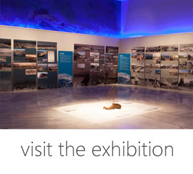
From the heyday period of the port in 14th century the archaeological excavations have discovered many household-and table ceramic vessels with sgraffito decorations, gold, silver and bronze jewelry, treasures of silver and gold coins and a large number of copper coins. Finds of earlier occupation periods are also numerous and part of them are on show in the little cave-museum on the site.
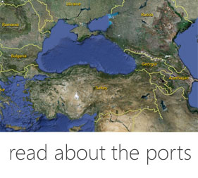
Harbor
Today: The harbor is abandoned and not in use at present. The bay of West of the cape where the ancient and medieval ports were located is now visited only by tourist- and fishing boats.
Past: The harbor of Tirizis – Akra – Kaliakra was located in the big and deep bay West of the cape, well protected of Eastern and North winds. It has been assumed that the port is a natural one and has had no additional underwater constructions for protection of waves. The artifacts found in the fortress and underwater – various types of anchors and anchor-stocks used during the 1st millennium BC, as well as amphorae and other ceramic vessels from 4th c. BC to 1st c. AD indicated that during that period it was used very actively. Trade relations were maintained with the Mediterranean- and the Black Sea regions as well as with Asia Minor, as most of the discovered amphorae come from almost all wine producing centers in these regions. During the Roman period the population of the cite decreased and trade contacts with other regions were not so active. In 4th – 6th c. AD the fortress became once again an important strategic- and sea trade center. Findings of the period indicate that trade was active with Constantinople and other large Black Sea- and Mediterranean cities. However with the increasing barbarian pressure and invasions from North, the trade and harbor activities gradually decline and when in the beginning of 7th century the fortress was destroyed and abandoned, the harbor ceased to exist too. It became well known to seafarers again in Medieval period and was marked on many sea-fare maps and portolani from 13th – 17th centuries. The name Сaiacra appears for the first time on the Pisan sea-fare map of 13th century, as well as in the oldest known portolan - Compass in sailing dated 1296. In many Genovese and Venetian portolani 13th-15th centuries, Kaliakra is recorded as a harbor located some 40-50 miles North-East of Galata or Varna. More details for the port are provided in a Greek portolan dated 1553, which is a copy of an older loci dated 14th century: Kaliakra is a good harbor with perfect visibility. The Kaliakra cape and it has 6 spans to the bottom. How to recognize Kaliakra: on the top of the cape there is a red castle, there are standing three hills and in the middle of the cape is a forest. There are 18 miles from Kaliakra to Balchik. In Medieval times Kaliakra was an important center for crafts and trade. From the harbor of the town were exported large quantities of grain and other cereals, although Varna and Anchialo were the most important export centers for crops. According to some Ottoman documents dated 18th century, because of the hardship in transporting the goods on the narrow and steep trails in the cliffs, the commodities were lowered to the docks in well-like holes cut to the foot of the cliffs. One such large hole/ cave was cut near the first fortress wall. The grain fell into a cave – warehouse from where it was loaded directly onto ships.
The harbor has no specially build port constructions except maybe a little pierce. It could be reached through steep and narrow trail on the west slope of the cape.
Fortification
The three fortification lines described above in details are well preserved: 1. of the outer town – a stone-built Late Antique wall overlapped by a Medieval earthling with a tower – gate; 2. of the pomerium: a stone-built wall with a ditch, towers and gate, and 3. of the citadel – the wall with the gate and a tower-donjon. The three fortification lines have been erected in at a certain distance one from another in North-South direction.
Medieval Sites
The well preserved and partially reconstructed three consecutive fortification systems with walls, towers, gates and ditches date from four different time periods: Hellenistic, Roman, Late Antiquity and Middle Ages are exposed for the public. At some places the wall’s height is over 10 meters with well-preserved gates, towers and big parts of the walls. The best preserved are the structures of Late Antique period: baths, four single nave and one cruciform basilicas and churches, one rock-cut monastery, public buildings, wells, cave dwellings and rock monastery cells, etc. Well presented is also the palace of the Medieval governor/ Despot is also well investigated and underwent a partial conservation. In one of the caves a small museum exhibition with findings from the fortress – amphorae, pottery, stone architectural details and more is presented. The site is provided with many walkways, places to relax and observation areas, souvenir shops, restaurant and there is a modern chapel built at the cape tip. From the cape there is magnificent view to the North-Eastern Black Sea coast. In this nature reserve many species of rare birds and plants with local origin may be observed, some of the later being endemics.
Textual Sources
Strabo VII, 6, 1.
Ptol. 3, 10, 1.
Arrian. Peripl. Pont. Eux. 24.
Аnn. Peripl. Pont. Eux. 75-77.
Pomp. Melam, 2, 22.
Пътеводител” на Хиерокъл (VІ в.). – ГИБИ ІІ, 89.
Хронография” на Йоан Малала (VІ в.). – ГИБИ ІІ, 209–210.
Хроника” на Йоан Антиохийски (VІІ–VІІІ в.). – ГИБИ ІІІ, 35–36.
„Земеописание” на неизвестен автор от Равена (края на VІІ–началото на VІІІ в.). – ЛИБИ, І, 92–393.
Списък на далечните и близки градове (края на ХІV в.). – М. Тихомиров. “Список городов дальных и ближних”. – Исторические записки, 40, 1952, 216–217; В. Гюзелев. Българските земи в чуждестранните географски представи. – ВИСб, 2, 1984, 24.
Хр. Коларов. Хрониката на Калимах – важен извор за варненската битка през 1444 г. – ИВАД, VІ (ХХІ), 1970.
Дневник на Антонио Бербери, ковчезник на граф Амадей VІ Савойски по време на похода срещу Българското Черноморие (1366–1367 г.). – Л. Горина. Материалы дневника Антона Барбери по истории Болгарии и Византии. – ВВ, ІV, 1973, 234–250.
Решение на сената на Венеция за отговор на пратениците на крал Сигизмунд, преминал през Ликостомо, Калиакра, Константинопол и Дубровник след битката при Никопол” (26 януари 1397 г.). – В. Гюзелев. Венециански документи за историята на България и българите от ХІІ – ХV в. – Архивите говорят, 18, 2001, 162.
Писмо за поражението пре Варна, изпратено до кардинал Лудовик от Андреас ди Палацио (16 май 1445 г.). – М. Мирчев. Андреас де Палацио. Писмо за поражението при Варна, изпратено до кардинал Лудовик. І ИВАД, ХV, 1964, с. 87–92
Списък на крепостите подчинени на варненския митрополит (юли 1370 г.). – В. Гюзелев. Извори за средновековната история на България (VІІ–ХV в.). В австрийските ръкописни сбирки. София, 1994, с. 194)
Анонимен италиански портулан (ХІV–ХV в.). – Б. Димитров. България в средновековната морска картография ХVІ–ХVІІ в. София, 1984, с. 32–33)
Ориентиране по корабоплаване (т. нар. Компас за навигация)” (ХІІІ в.). – Б. Димитров. Българските пристанища в ХІІІ–ХІV в. според два портулана. Археология, ХХІ, 1, 1979, 21.
Италиански портулан (препис от ХV в. по оригинал от началото на ХІV в.). – П. Коледаров. Мореплавателни карти, наръчници и други свидетелсва за международното значение на Втората българска държава. – Сб. България в света от древността до наши дни. София, 1979, 293–294.
“Генуезки портулан” от началото на ХІV в. – В. Гюзелев. Българската държава в актове и документи. София, 1981, 188, бел. 13.
Венециански портулан” (ХІV в.). – Б. Димитров. България в средновековната морска картография ХVІ–ХVІІ в. София, 1984, 34.
Анонимен италиански портулан” (от ХVІ в., но е препис по данни от ХІV–ХV в.). –Б. Димитров. България в средновековната морска картография ХVІ–ХVІІ в. София, 1984, 36..
Анонимен италински портулан” (съставен вероятно през ХІV в., но известен по препис от ХV в.). – Б. Димитров. България в средновековната морска картография ХVІ–ХVІІ в. София, 1984, 37.
Х. Шилтбергер. Пътепис. Превод от немски по Нюрнбергския ръкопис на М. Кисилинчева. София, 1971, 84.
Атлас. Българските земи в европейската картографска традиция (ІІІ-ХІХ в.). София, 2008, № ІІ, 2 и сл.
Bibliography
G. Mihailov. Inscriptiones graecae in Bulgaria repertae, 12
Serdicae, 1970, Nos. 42-44.
M. Oppermann. Die Westpontische Poleis. Langenweiβbach, 2004.
A. Balkanska. Tirizis –Tirisa - Acra. Die thrakische und römisch-byzantinische Stadt am Kap Kaliakra.(Scythia Minor). – Klio, 62, 1, 1980, 27-46.
Б. Димитров, А. Орачев. Пристанищната система по Западнопонтийското крайбрежие (средата на ІІ-І хилядолетие пр. н. е. –Археология, ХХІV, 1, 1982, 1-11.
В. Гюзелев. Средновековната крепост на Калиакра през ХІІІ-ХІV век. – ИНМВ, 9 (24), 1973, 123-139.
В. Велков. Антична колонизация. – История на Добруджа, 1. София, 1984, 101.
К. Порожанов. Датировката на каменните котви с отвори от българското чепноморие. – Археология, ХХХІ, 1, 8.
В. Гюзелев. Добруджа от края на ХІІ до ХV век. – В: История на Добруджа, 2. В. Търново, 2004, 300-305.
Г. Китов. Калиакра през античността и средновековието. –ГСУ-ФИФ (История), 64, 3, 1971, 1-20.
М. Лазаров. Древното корабоплаване по Западното Черноморие. Варна, 2009, 114-115.
С. Торбатов. Укрепителната система на провинция Скития (края на ІІІ-VІІ в. Велико Търново, 2002, 226-232.
Г. Джингов. Калиакра. Крепостно строителство. Том 1. София, 1990.
Links
Tourist Information: http://shabla.be/region/kaliakra/

 DIGITAL MEDIA STUDIO