Name
ObzorCurrent Name
ObzorAncient Name
Naulochos (c. 4th – 1st c. BC), Templum Iovis (c. 1st – 3rd c. AD)Medieval Name
Naulochos (4th-6th c. AD?); Kozyak (12th – 15th c.); Kolocastro (13th c.), Gyoseken (16th c.)History of the name
Strabo mentioned the ancient settlement Naulochos as a small town of Messembriani (i. e. founded by the citizens of Mesambria). The ancient fortress within the town limits was known during Roman period with the name of Templus Iovis. It was marked on the Tabula Peutingeriana (3rd c. AD) between Messambria (Nesebar) and Erite (on the mouth of Kamchia River, ancient Panyssos). In the Late Antique period, the settlement most likely returned its initial name Naulochos Between 12th and 14th centuries when this region was included in the territory of Second Bulgarian, a new big fortification was erected on the heights located North-West of the ancient site and it was named Kozyak, In an Western historical chronicle of mid c. 14th century the same fortification was mentioned as Kolokastro same while during Ottoman period – c. 16th century it was named already Gyoseken, a modification of Kozyak, though having the meaning in Turkish a beautiful view. The modern name Obzor is actually a free translation in Bulgarian of the Ottoman name.
Place :
Country
BulgariaGeopolitical Unit
Balkan peninsula, Western Black sea coastAdministrative subdivision
Burgas Region, South-East regionLocation
Situated some 60 km south of Varna, South of Byala/Cape St. Atanas, at the South end of a large but poorly protected by the winds bay.Foudation Date
The ancient Naulochos was founded probably during 3rd c. BC by citizens of Messambria/Messembria. Strabo (late 1st c. BC- early 1st c. AD) calls it Messembria polychnon, i.e. a small town of Messembria, while Pliny (1st c. AD) called it opidum (fortification), still with the same name. However in the Tabula Peutingeriana, map of the ancient world probably of 3rd c.AD, the town was called already Templum Iovis, i.e. it has received this name between 1st and 3rd centuries AD. Probably it took place after the construction of the great temple dedicated to Jupiter in the city. The Late Antique fortress in Obzor was built probably in 4th c. AD. It has been destroyed and deserted at the end of 6th – beginning of 7th c. AD during the Avar and Slav incursions. The town was not occupied later and the fortification remained in ruins until Middle Ages. The Medieval fortress of 13th – 14th c. is situated on another location: on the heights South-West of Obzor and was known under the Bulgarian name Kozyak (meaning Goat-town), while the nearby river Dvoynitsa was then called Kozya reka (Goat river).Current condition
Obzor is a small, well-run resort town with population of about 3 000, who are mostly engaged in tourism, restaurants and hotel management, and as well in agriculture, viticulture and wine making. A long, wide and nice sand strip makes the seaside beach spread from Cape St. Atanas up to Emine Cape. Dozens of small and bigger hotels are built in the town, along with restaurants, bars and various recreation- and amusement establishments. The town is a popular tourist destination and from May to October it hosts theaters and musicians from all over Bulgaria who have their performances and concerts with classical, folklore and pop-rock music on local stages. The town has no industrial plants and there are a great number of small shops selling souvenirs, dresses, food, etc. The little pier on the beach serves mostly for mooring of local fishing- and tourist boats and smaller yachts as well. The town has a little museum where an exhibition of various chance findings ranging from Prehistory through Ancient and Medieval periods up to 18th century is on display. Within the town park various marble architectural units from Roman and late Antiquity periods are exhibited: columns, capitals and other attractive archaeological artifacts.History
The ancient settlement, which most likely was fortified, was founded by some citizens of Messambria c. 4th – 3rd c. BC, though probably on the same site existed and earlier – Thracian village, evidenced by a few isolated archaeological finds of earlier periods discovered in the modern town. The Ancient one did not have a particular importance during the Hellenistic period (late 4th -1st c. BC), which is evidenced by scarce findings from that time. The surrounding lands were possibly cultivated with some level of husbandry for supplying the inhabitants of the town. After AD 45, it was included in the Roman Province of Thrace and became a road station (mansio) on the important road running along the Western Black Sea coast: from Histria at Danube Mouth to Byzantion on the Bosporus. For some reasons on a high terrace above the sea there has been built a big temple dedicated to Jupiter, which seemingly has become very popular in the area. The huge marble architectural details (capitals, architraves, etc.) found on the site indicated that it was not the work of Naulochos residents, but this was rather an imperial idea completed c. 2nd – 3rd c. AD. The most possible date when the town changed its name to Templum Iovis is during that period. Archaeological findings dated to the 1st – 3rd c. AD (sarcophagi, marble inscriptions, ceramics and other) indicated that there was a population of wealthy citizens, who were engaged not only in agriculture or fishing, but as well with husbandry and trade. During contemporary civil engineering works in Late 20th-eraly 21st centuries there have been detected the remains of large Roman baths. Most likely during the Late Antiquity 9c. 4t-5th c. AD) new fortress walls have been erected and the temple of Jupiter was either demolished or heavily reconstructed as on its site was built a large Early Christian basilica with very rich marble decoration inside. Its huge marble capitals – over 1 meter wide indicated a very impressive civil engineering achievement, perhaps during the reign of Emperor Justinian І (6th c. AD). This is a sign that the importance of Naulochos (?) as a strategic stronghold for the defense of Haemus (Balkan Mountains) East-most section and the coastal road increased. Probably during that period the town changed again its name for the first one known. It seems that the fortification was seized and heavily destroyed during the Avars- and Slavs incursions at the end of 6th – beginning of 7th c. AD. Probably during the first half of 8th century, when this part of the Balkan Peninsula was incorporated into the Bulgarian Kingdom, the low seaside along the bay was especially defended by a long ca 2 m high earthwork rampart. It was designed to protect the valley and the two river courses there from possible landings of Byzantine military troops brought here by sea by the imperial fleet. The flat area there is very suitable for landing. Maybe in that time a limited garrison was stationed in the nearby ruins of the ancient fortification for watching and maintaining the rampart.
During the 13th century on the heights North-West of the ancient city a big fortress was erected by the Bulgarian state, which was named Kozyak. It is mentioned for first time in the 1305 poem by Manuel Files narrating the campaign of the Byzantine military leader Michael Glavas Tarchaneiotes in 1278: ... He took the entire lands of Emona. He was master of the fortress and town of Kozyak….
By the end October 1366 the fortress Kozyak, together with the fortress Emona, were attacked and captured by the knights of Count Amadeus VI of Savoy. The events were narrated in the Chronicles of Savoy under the heading How the stronghold Kolocastro (Kozyak) was captured by force and its population chopped in pieces. At that time, after the capture of Emona, loaded on a galley, a group of knights attempted to take by surprise during the night the Bulgarians defending the fortress. That attempt failed and all the attackers killed. Later on, Anthony, son of Count Amadeus VI, took the fortress with a group of knights and killed the defenders. Emona remained under knights’ control, while in Kozyak a Byzantine garrison was dispatched. By the end of January 1367 the Bulgarians in Emona rebelled and probably drove away from Kozyak the small Byzantine garrison.
In 1369 the Bulgarian Tsar Ivan Alexander transferred the possession on Kozyak and Emona fortresses, undoubtedly until then within the Kingdom of Tirnovo, to Despot Dobrotitsa, ruler of the separated Despotate of Dobroudja. The two fortifications were included by the Despot within the Diocese of the Metropolitan (Bishop) of Varna. Kozyak was mentioned in a document compiled in June 1372, which says: His Holiness the Metropolitan of Messembria, ipertimos and proedros of Anchialo, in soul beloved brother of our humility and fellow servant, sir Anthony, following a general meeting of those holy pontiffs found in Constantinople and in his presence and seating with our humility, started exposition on the matter of point that his diocese among others, which are subjected to it, since long ago belong two fortresses near Nessebar, one of which locals call Kozyak, and the other – Emona. These are held in possession by the happiest Despot Dobrotitsa and fall under the pontiff spiritual care of the man who now sits as Varna Metropolitan.
During the reign of Bulgarian Tsar Ivan Shishman both fortresses – Kozyak and Emona were included again within the Kingdom of Tirnovo. It is referred in the work of Mehmet Neshri (1493) Mirror of the World. When providing the list of fortresses belonging to Tsar Ivan Shishman, Neshri mentioned the fortress of Gyoske (Kozyak) too.
The Kozyak fortress fell under Ottoman rule rrobably by the end of 14th century, when in 1396 was conquered Messembria. Most likely it was partially destroyed and later deserted by its inhabitants. Probably the population moved back to the site of ancient Naulochos, modern Obzor.
Description
The fortress has not been excavated. It was described by K. Shkorpil at the beginning of 20th century, when its remnants and traces were still visible. The fortress consisted of two sections. The South-East one was shaped as a hexagon, measuring 40х60 m, with a tower on its North wall. The North side of the fortress was the lower one and it was shaped in rectangular form in direction North – South with dimensions 80x160 m, having a tower on its North-East corner. It was built of crushed stones fixed by white mortar. During the 80s of the 20th century on the supposed site of the ancient temple dedicated to Jupiter was undertaken limited in scope test excavation but the results remained unpublished. A few sections of massive walls and some architectural units of a large Early Christian basilica and dated 6th century AD were found onsite. Some of them and some other marble architectural units from Roman and Late Antique period discovered during contemporary construction works in the town are exposed in open air in the Town central park.
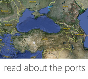
Harbor
Today: Nowadays the town has no port. The bay of Obzor is not much favorable for mooring because it is very wide and open to the East – Northeast. The existing pier is used only by small fishing- and tourist boats.
Past: In the aquatory of Obzor Bay were found and collected three lead Ancient anchor stocks which is a proof that the bay was available for coastal sailing by the end of 1st millennium BC and during Roman period (1st-3rd c. AD). Most probably the town was using for its needs also (and maybe mostly) the port located on the North shore of the bay, South of cape St. Atanas, which was in fact the port of the ancient town near modern town of Byala. This harbor is well sheltered from the winds and very comfortable for embarking.The same tradition was kept also by the citizens of Medieval town of Kozyak in 13th-14th c. when the port was marked on sea-fare charts and portolani as Visa. However, due to its distance of 2 – 3 km away from the coastline (as is the case of Kranea), Kozyak was not marked on Medieval sea-fare charts and portolani.
A port named Gyoske is mentioned in the Port Law of Sultan Süleyman I form mid-16th century. The legislative document provides information about the fee and charges for import- and export of goods. The port was trading with timber, wood, wine, wheat and barley. This harbor is not located for sure but most probably it goes again about the one South of Sveti Atanas Cape.
Fortification
There are no data for the location of the ancient fortress wall of Naulochos/ Templum Iovis, because at present the area of ancient town is densely built. Its layout was drawn and a short description was written by Karel Shkorpil in the beginning of 20th century. The foundations of the Medieval stronghold Kozyak are preserved on a hill outside the modern town of Obzor but no excavation has been conducted on the site yet.
Medieval Sites
In Obzor there is a little museum founded by a local enthusiast, where a number of archaeological artifacts of various periods are on display. There are finds of Chalcolithic period (5th millennium BC), pottery, dress decorations, jewellery, marble reliefs and everyday life objects of Early Iron /Thracian Age (6th-4th c. BC), Greek and Hellenistic (4th-1st c. BC), Roman (1st-3rd c. AD) and Medieval (13th-15th c.) periods as well as a number of coins. There can be seen also some ethnographic and historic materials from 19th – early 20th centuries. A number of marble units and other fragments from decoration of ancient public buildings and temples are exhibited in the Central park of the town. The location of the big ancient temple dedicated to Jupiter, which actually gave the name of the town during Roman period: Templum Iovis – Temple of Jupiter and later an Early Christian basilica is not excavated but it is planed for the years to come.
Textual Sources
Strabo, 7, 319; 9, 440;
Plin. N. H., 4, 11, 45;
Annon. Peripl. 81-83 (ed. Diller)
Tab. Peut.
Атлас. Българските земи в европейската картографска традиция (ІІІ–ХІХ век). София, 2008, № ІV, 1.
Подвизите на известния чутовен протостратор” на Мануил Фил (около 1305 г.). – ИБИ, ХХІІ, 1980, 148.
“Савойска хроника”. – П. Петров, В. Гюзелев. Христоматия по история на България, 2. София, 1978, 272.
Решение на Синода на Константинополската патриаршия за връщането на крепостите Козяк и Емона на Несебърския митрополит” (юни 1372 Г.). – В. Гюзелев. Извори за средновековната история на България (VІІ–ХV в.). В австрийските ръкописни сбирки. София, 1994, 197.
Bibliography
М. Гюзелев. Западният Понт между Емине и Босфора през първото хилядолетие пр. Хр. Бургас, 2009.
Ал. Кузев. Козяк и Емона. – В: Български средновековни градове и крепости. Варна, 1981, 316-325.
М. Лазаров. Древното корабоплаване по Западното Черноморие. Варна, 2009, 110.
Р. Рашев. Старобългарски укрепления на Долния Дунав. Варна, 1982, 45.
Х и К. Шкорпил. Североизточна България в географско и археологическо отношение. СбНУ, VІІІ, 1892, 42.
Links
Visual Material
Tourist Information: : http://www.obzorcity.com/index.php/2011-12-08-12-25-56/2012-02-12-11-56-29/67-muzei

 DIGITAL MEDIA STUDIO