Name
AkhtopolCurrent Name
AkhtopolAncient Name
Alu AgathopolisMedieval Name
Agathopol, Akhtopol, GatopoliHistory of the name
Some scholars located on this site the settlement Aulaiouteihos mentioned in the 3rd c. AD Periplus of Arian. This name has Thracian origin and could be translated as “ a surrounded by wall tower”, which means that the earliest settlement on this site was a fortified one. Some finds underwater in the bay of Akhtopol and a section of a typical in construction fortification provided information about a Thracian settlement of Early Iron Age in the area. The name Agathopolis is encountered mostly in Medieval sources and has a Greek origin: agatha meaning wealth, goods, and polis –a city. Hence the name can be translated as a City of prosperity.
Place :
Country
BulgariaGeopolitical Unit
Balkan peninsula, Western coast of Black SeaAdministrative subdivision
Burgas Region, South-East RegionLocation
Akhtopol is situated on a picturesque rocky peninsula on the Black Sea at the foot of Strandja mountain. It is located some 90 km South of Burgas and very close to the country border with Turkey.Foudation Date
It is generally assumed that in 5th c. BC, a little apoikia of Athens was founded on the site of an existing for several centuries little Thracian town, which probably was fortified and bore the name Aulaiouteihos. The fortification walls of the Greek town were erected most likely in 1st c. BC and the town became a fortress part of the fortification system of Astika region within the Thracian/ Odryssian Kingdom located in the Southeastern part of the Balkan peninsula. In AD 45 it was included in the newly established Roman imperial Province of Thracia. During the early 4th c. AD the town became part of the Late Roman province of Haemimontus. At the end of 5th c. the town was fortified by very strong walls surrounding the entire little peninsula. The same one was used probably with some repairs during Middle Ages.Current condition
Akhtopol now is a town in Municipality Tsarevo, Burgas Region, located near the frontier with Republic of Turkey. It has a population of 1 444 and is a resort center with many little and bigger family hotels, shops and restaurants. The town is situated around a picturesque rocky bay with a little beach. It is a fishing port and starting point for various tourist excursions in the mountain and along the pretty wild and dramatic Black Sea coast in this area, where more little beaches are scattered, that attract visitors and tourists wanting privacy for their vacation. There is an old church with nice 19th c. icons and a little privately owned Archaeological museum, located in a hotel. Its rich collection of artifacts discovered underwater offers an interesting excurse through tens of centuries of sea-faring in the Black Sea.History
It has been generally assumed that the Ancient and Medieval town did not have a great importance despite that it had a relatively good harbor closed for the North winds and protected in front by underwater reefs that served as wave-breakers in the past. In most of past historical periods it was often avoided by both merchant boats and historians because it was established in a relatively remote area, away of big roads and very close to the deep forest region of Strandja Mountain. Besides, Akhtopol was in a difficult for transportation on land area that rarely was theatre of wars or military campaigns. This is the reason why it almost did not fell in focus of Ancient or Medieval chronicles before 6th c. AD and later – prior to 12th century. Even later this did not happen often. However, archaeological finds on land, on the shore and underwater revealed a different picture. Remnants of a possibly Thracian ancient house of 4th-3rd c. BC as well as imported Greek black-glazed pottery, amphora fragments and roof tiles discovered by excavations in the town as well as a 5th c. BC coin of Cyzikos made of electrum helped to assume that the town and its port were quite active in Late Classical and Early Hellenistic periods. In an inscription of the same time discovered by chance in modern Akhtopol, some special relations with Athens have been mentioned while in another one, similar links to the Black Sea ancient city of Odessos (Varna) have been noted. It has been suggested that a fortification was erected on the peninsula ca 1st c. BC. Scarce pottery finds and coins of Roman period (1st-3rd c. AD), among these a 2nd-3rd c. AD marble votive relief of the Thracian Horseman deity proved the existence of the town with mixed population in that time too. Agathopolis was included also in the 3rd c. AD Periplus of Arianus as a functioning port. The Late Antique town was not mentioned by Procopius among those fortified by new walls during the reign of Emperor Justinian І (527-565). Most probably this has happened earlier: at the end of 5th century AD during the reign of Athanasius I. It seems that then a new fortress replaced the Late Hellenistic one, which was probably in use until then, but already outdated and maybe ruined.
Agathopolis was seized and included in the boundaries of the First Bulgarian Kingdom after the campaign of Khan Krum against Constantinople in 812 and its name was mentioned in the inscription on a triumphal column in the capital Pliska, where all his victories and captured Byzantine fortresses were listed. Maybe then it gained it Bulgarian name Akhtopol, derived from the Greek Agathopolis. The town was most likely regained temporarily by Byzantium and between 864 and 894 until the campaign in that year of Bulgarian Tsar Simeon against Constantinople, because it is mentioned in the Notitiae Episcopatuum from the reign of Byzantine Emperor Leo VІ (886-912). Akhtopol remained under Bulgarian control until the conquest of Eastern part of Bulgaria Bulgaria by Emperor John Tzimiskes in 971. Maybe in 11th c in the town was established a Medieval monastery named Sveti Ivan / Sveti Yani (dedicated to St John the Baptist), which survived through the centuries with various changes and reconstructions lasted until 1945, when the communist regime in Bulgaria ordered its destruction.
Based on given geographical data, supposedly Akhtopol was mentioned in the Geography of Guido (1119), but with a different name – Bautikon: Further ahead from the mentioned Kimerium on the Black sea coast to the city of Messembria in Thrace there are fortified cities and in the sum must be included 13 000 miles. Afterwards follow the cities: …9. Anchialos (Pomorie)10. Apollonia, 11. Terra (Primorsko), 12 Bautikon (Akhtopol).
Under the name Agasubulis the town is mentioned among the big cities along the Black Sea coast in the Geography of 1143 of the famous Arabian geographer al-Idrisi:
The road from Constantinnia to Mitraha (?) on the North shore of the Black sea...from Agasubulis.(Akhtopol)... to Basiliku (Vasiliko/ Tsarevo) to Suzubuli (Sozopol) – 25 miles.
The city is listed as belonging to the Episcopal See under Haemimontus Metropolitan in a Notitia Episcopatuum from the beginning of 11th century.
Akhtopol is a name encountered in the narratives of the campaigns for liberation of Bulgaria of the nobles Asen and Peter brothers in 1187. According to Nicetas Choniates within the city area were dislocated Bulgarian troops supported by Cuman cavalry: When the emperor (Isaac II Angelos) directed himself to Agathopoisl in order to stop barbarian incursions... During the reign of Tsar Kaloyan (1197-1207), Akhtopol remained within Bulgarian Kingdom, because it was not mentioned among the fortresses captured and distributed among the Western knights after the conquest of Constantinople by the Fourth Crusade march in 1204. This may be the reason why Akhtopol was attacked and the region around the city sacked by the knights of the new Emperor in Constantinople: Heinrich during autumn 1206.
The town came again to the focus of Byzantine chronists like George Pachymeres in 1263, when in the region of Akhtopol were dispatched the troops of Bulgarian Tsar Constantine Tikh (1257-1277) before the battle of Visa. Soon after the city was conquered during counterattack led by the Byzantine commander Michael Glabas Tarchaneiotes.
Akhtopol returned under Bulgarian control during the 1304 campaign of the Bulgarian Tsar Theodor Svetoslav (1300-1322) against Byzantium. In his chronicle George Pachymeres noted that Akhtopol was conquered together with Sozopol, Messembria, Rusokastro and Anchialos. Soon after, the city was included again in Byzantine territory, because in a rewarding charter of Emperor Andronikos II Palaiologos (1282-1328) from 1316 to the citizens of Menemvassia in Peloponnesus was granted the right to export without customs duties meat from the Strandja region fortresses: Sozopol, Agkhopol and Mydia. The treaty of 1307 transferred to the Bulgarian Tsar the Black Sea fortresses, including Akhtopol, as dowry for his marriage with Theodora, daughter of the Byzantine co-Emperor Michael IX Palaiologus (1294-1320).
After 1322, for a short period of time the town returned to Byzantium, but then again regained for Bulgaria after the victory of Tsar Ivan Alexander (1331-1371) over the Byzantine army near Rusokastro in 1331.
Like all other Black Sea fortresses Akhtopol was attacked by the knight army of Amadeus VI of Savoy in 1366. It was actually the first Bulgarian city (called erroneously Mahopoli) besieged on October 4th and taken on October 1st the same year. According to the 1367 peace treaty between the Count and the Emperor John V Palaiologos, the city was handed over to Byzantium and was included in the territory of the new Despotate named Zagora ruled by the fourth son of Emperor Michael Palaiologos.
The city remained under Byzantine control until 1389, when the Ottomans conquered Adrianopolis, because according a decision of Constantinople Synodos the Metropolitan of the conquered city was transferred to Agathopol: And at that time the Holy Bishopric See Agathopolis being under his control is located on the sea shores, thus providing significant comfort to its population.
Being under Ottoman control after 1389 together with all other Black Sea fortresses, the town was probably again ceded back to Byzantium with the treaty between the Christian League and the Emir Süleyman Çelebi in 1403 „together with [the lands of] Paroria”: To my father - the Emperor of Greeks and to the Empire of Constantinople I handed Thessaloniki with Kalamaria … and what they gave to my father, I hereby return to them and surrender from Panido to Nessebar, together with Paroria (Strandja Region) and the fortresses and the saltpans and all belonging to these, which I gave without any tribute to my father – the Emperor.
Akhtopol was finally conquered by the Ottomans in 1453 and its population like that of the fortresses on the coast North of it was resettled to the depopulated Constantinople. Ever since the town remained a little location populated mainly by fishermen and only occasionally its harbor was used for trade and export of locally produced agricultural goods and timber from located near forests. In 1918 the Late Medieval town with picturesque wooden houses was ruined by a spontaneous fire and only a few hoses and a church survived intact. In the 20ties and in later decade, a number of totally new buildings covered the old town.
Description
The fortifications of Late Antique Agathopolis and Medieval Akhtopol have been archaeologically investigated since the late 90s of 20th century. With some interruptions, the work is in progress until present time, as well as conservation works have been applied at certain points of the fortress. The ancient walls included the heights at the end of Akhtopol peninsula. The revealed by excavation remnants of the wall ran straight and originally have blocked the access to the cape neck at some 200 m length. There it is 2.8 m thick, while in the lower areas of the slope it is thick from 1.5 to 2 m. Two square in shape towers were discovered in the Eastern part and at the South-west corner. On the west transverse wall are located stairs. The wall was build by worked stones of medium size fixed by means of red mortar. At some locations it has been preserved at heights of ca 2-3 m. After 5th c. AD onward, most likely the fortification was repaired at several occasions. On some places it has collapsed due to earthquakes that happened both in Medieval and later times, the later one registered in 18th c., when the survived more or less until then Late Antique/Medieval fortification walls were ruined to a large extend. The investigation of the fortification will continue in future too.
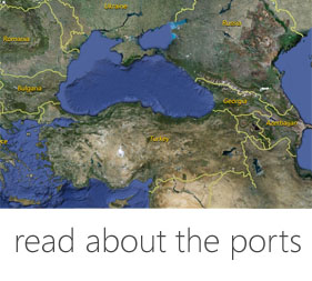
Harbor
Today: The present harbor of Ahtopol is located in the bay South of town, where the port during Antiquity and the Middle Ages has been located too. The modern port is of local importance only. Today it serves mainly for pier of fishing boats and small- to medium size yachts and has good facilities for landing.
Past: The port of present Akhtopol in ancient time was a natural one, because during underwater surveys there have been found no traces of artificial installations. Part of the peninsula has submerged in the past and was traced recently by underwater research works to about 10 m ahead of its modern coast line. At 17 m depth in Akhtopol bay there have been discovered several ca 3rd-4th c. AD stone anchors (which might be well of an earlier period) and lead anchor stocks of 3rd c. AD, as well as iron anchors of 1st-3rd c. AD. Ancient and Medieval pottery was discovered regularly by fishermen in the aquatory of Ahtopol bay. In addition, some of the many other iron anchors that have been found underwater in the bay, have been dated from Ancient to present times. Taking into account the artifacts found and the variety they represent, it is obvious that Akhtopol bay was operating actively during both Antiquity and Middle Ages. In Ancient times, the naval situation in the area of contemporary Akhtopol bay was pretty much the same as today. The reef located near Migalkata rock protected to some degree the Ancient harbor from the North-East winds. It must be noted that in Akhtopol was reported the strongest storm throughout the Black Sea West coast. It happened in 1976 and the waves reached up to 14 meters. Obviously this part of the Black Sea coast was subject to intensive storms and maybe this is one of the reasons why despite its convenient location and bay Ahtopol failed to establish itself as significant port center in Antiquity and the Middle Ages.
Agathopol port was included in the Italian trade with the Black Sea region during the second half of 13th century. It was mentioned as good port for boats in the Compass in sailing dated 1296 with the name Gatopoli: From Vitopoli to Gatopoli 20 miles North- West to quarter North. The above mentioned Gatopoli is a good port for boats.
An Italian portolan of 14th century mentions the city port North of cape Ineada: From Inda (cape Ineada) to Agatopoli (Agathopol) to Vergonise (Urdovisa, modern Kiten) south-west is 20 miles. Vergonise can easily be passed by. From Vergonise to Sika (Primorsko) on 4 degrees north-west is 10 miles. From Sika to Sizopoli (Sozopol) South-North-West is 10 miles.
Similar data are provided by another 14th century anonymous Italian portolan: From Inda to Agatopoli to Vergonisi from West to East are 20 miles. Vergonisi missed a little to be an island.
In another portolan from mid-14th century the port is listed among the Byzantine harbors: ... belonging to Romania: Malatra, Mydia, Strigeti, Getopoli, (Agathopolis) Axine, Gyxopoli.
In a Venetian portolan issued in 16th century the port is mentioned with the name Agatopolis: From Tiniada to Agatopoli from south to north there are 15 miles. From Agatopoli to Verniso from west to east there are 20 miles.
The port of Akhtopol was marked on dozens of maps dated 14th – 15th centuries with black letters, which means it was an important one. For the first time the name Gatopoli (Agathopolis) was encountered in the 1311 map made by Petrus Visconti. With the same name it was marked in the subsequent maps by the so-called “Genoese cartographer” drawn before 1320. The traditional name remained the same on various sea-fare maps despite the fact that the town changed its rulers many times during 13th-16th c. It was marked for instance on the 1325 map of Angelino de Delporto; on an anonymous map dated 1351; on the 1367 and 1373 maps of Francesco Pizzigano; on the 1385 map of Guillelmo Solleri; on the 1403 map of Francesco Beccaro; on 1413 map of Messia de Valadeste; 1447 map of Gabriel de Valseca; 1474 map of Graziosa Benincasa; 1490 map of Alvise Cesano, as well as on many later compiled maps. The city is mentioned as well with the names Gadopoli (Henricus Germanicus, 1489), Gastopoli (Hayme Olives, 1563 and Mateo Prunes, 1586). Later on the town almost disappeared from historical chronicles and maps but it served
Fortification
The foundations of present day preserved walls are dated from 5th century AD. The walls some 2.8 m thick blocked the cape neck at a distance of ca 200 m. It was built by well worked rectangular stones fixed by means of red mortar. A gate and square tower were present on the West side of the wall, which in ancient times blocked completely the peninsula neck. Most likely the same fortification was in use also in medieval period (11th-15th c.) but it was obviously repaired at several occasions until 1453. Its remnants were ruined by a catastrophically earthquake in 18th c., as depicted on a contemporary etching of the town.
Medieval Sites
Interesting sites preserved until present are: large sections of the excavated Late Antique/ Medieval fortress of the town (5th-15th c. AD) in the central part and harbor area of the modern one; the 1776 church Ascension of Our Lord; ruins of St. Yani monastery of ca 12th century. Near the peninsula at a height about 14 km south of town ruins of a Thracian fortification have been excavated too. There is a little Town museum with collection of interesting artifacts, photos and documents of various historic periods: from ca 5th c. BC up to early 20th c. Concerning the history of Akhtopol. Another small museum known as “Museum of Anchors” is privately owned and housed in a hotel is dedicated to Ancient and Medieval sea-fare and sailing. A number of anchor-stocks and anchors: stone-made, as well as lead and iron ones, along with some, anchor reconstructions other Ancient and Medieval artifacts, maps, etchings and photos provide a very well presented scientific approach to the sea-fare experience of all nations who lived on the Black Sea coast from 1st millennium BC up to 18th-19th c..
Textual Sources
П. Коледаров. Мореплавателни карти, наръчници и други свидетелсва за международното значение на Втората българска държава. – Сб. България в света от древността до наши дни. София, 1979, 293–294.
Б. Недков. България и съседните й земи в средата на ХІІ в. според „Географията” на Идриси. София, 1960, 70, 77, 81, 99.
География” на Гвидо (1119 г.) (ЛИБИ, ІІІ, 131)
Савойска хроника” (Съставена от Йохан Сервион през 1464–1465 г. според една стара редакция от 1417–1420 г.). – П. Петров, В. Гюзелев. Христоматия по история на България, 2. София, 1978, 272.
Ориентиране по корабоплаване (т. нар. Компас за навигация)” (ХІІІ в.). – Б. Димитров. Българските пристанища в ХІІІ–ХІV в. според два портулана. Археология, ХХІ, 1, 1979, 21.
Л. Горина. Материалы дневника Антона Барбери по истории Болгарии и Византии. – ВВ, ІV, 1973, 234–250.
Атлас. Българските земи в европейската картографска традиция (ІІІ–ХІХ век. София, 2008, карти №№ ІІ 2–25.
A. G. Roos. Flavii Ariani quae exstant omnia. Bibliotheca scriptorium graecorum et latinorum Teuberiana. Lipsiae, 1928: 1908a.
Bibliography
Б. Азманов. Историческо-археологически данни за античния Ахтопол. – Анали, 1-4, 1997, 24-43.
М. Гюзелев. Западният Понт между Емине и Босфора през първото хилядолетие пр. Хр.. Бургас, 2009, 269-272.
Н. Недев. Крепостта Агатопол пред древността и средновековието. – ВИСб, 2, 1971.
Б. Димитров. Агатопол. – В: Български градове и крепости по Дунав и Черно море. Варна, 1981, 412.
Б. Димитров. България в средновековната морска картография ХVІ–ХVІІ в. София, 1984, 16.
А. Орачев. Блаженият град Ахтопол – Агатополис. Ахтопол, 2012.
A. Avraм. Zu zwei Inschriften aus Agathopolis. In: Jubilaeum V. Сборник в чест на проф. Маргарита Тачева. София, 2002, 20-21.
V. Velkov. Le port de la colonie grecque Agathopolis. – Thracia Pontica, V. (Varna), 1994, 105-112.
Links
http://bg.wikipedia.org/wiki/%D0%90%D1%85%D1%82%D0%BE%D0%BF%D0%BE%D0%BB
https://www.facebook.com/pages/%D0%9A%D0%BC%D0%B5%D1%82%D1%81%D1%82%D0%B2%D0%BE-%D0%B3%D1%80-%D0%90%D1%85%D1%82%D0%BE%D0%BF%D0%BE%D0%BB/227217947349685

 DIGITAL MEDIA STUDIO